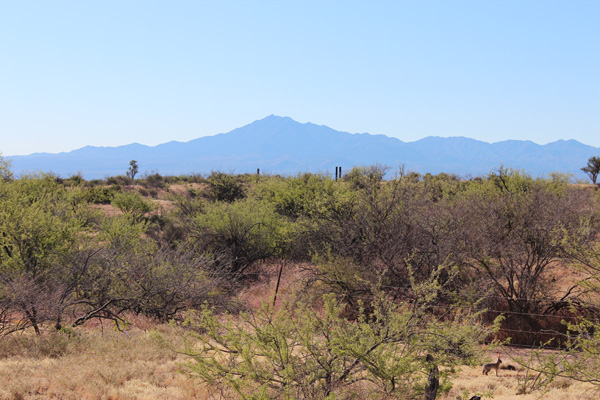
On April 2 several friends and I climbed Mount Turnbull, the highpoint of the Santa Teresa Mountains of Southeast Arizona. Mount Turnbull has 8282 feet of elevation and 3562 feet of prominence, the 15th most prominent peak in Arizona.
That morning I met Eric Kassan, Richard Hensley, Kay Komuro, Maymay Au, and Fan in Peridot. Here we purchased San Carlos Apache Tribal Recreation Permits for our visit.
This was the fourth weekend I had joined Eric in his explorations of Arizona prominence peaks. This was an unexpected and fortuitous opportunity this winter season. This day’s adventure included long drives on primitive roads, climbing across and up steep, brushy, and rocky slopes, and climbing exposed rock slabs to reach a very scenic summit.
From Peridot we drove southeast on US 70 and turned west onto the Coolidge Dam Road. To approach Mount Turnbull we turned off Coolidge Dam Road onto the signed primitive road 556. We followed this road for many miles. Eric had verified as best he could via Google Maps that this road was passable and would lead us high on the northern slopes of Mount Turnbull.
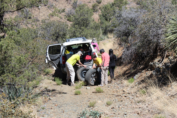
Eric lead the drive in and I tried to keep up in my Jeep. Road 556 dropped into and out of several drainages where the road was sometimes particularly narrow and rocky. As we climbed out of one drainage Eric suddenly stopped with a rock-cut flat tire. Eric swapped the flat tire with his only spare tire. I would have considered retreating after using my only spare tire, but Eric decided to continue traveling the rocky access road, though a bit more cautiously with me in the lead this time.
We continued driving in on road 556 and gradually climbed onto a north-facing ridge. Here we met another road approaching from our left. This road appeared to be more frequently traveled than the one we were using. We thought we might take that road on our departure. We soon climbed a steep and somewhat loose section of road. Soon we parked at about 6280 feet in a pullout rather than continue driving up the steep road.
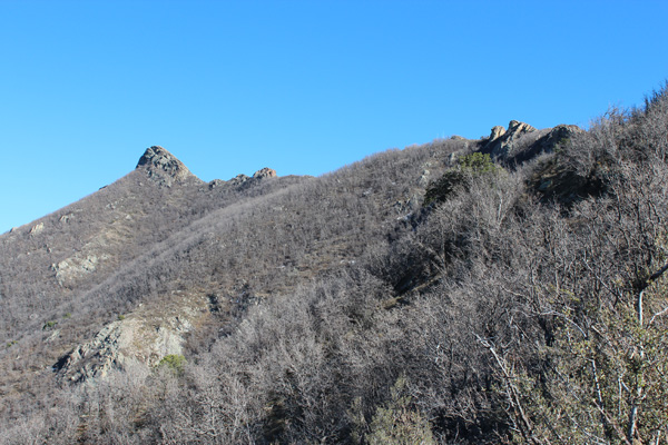
From our cars we climbed the road about 1000 feet past a large parking area to the end of the road. Here a trail continued on. The summit is visible from here on the left in the above photo. The trail traversed across and up the brushy north slope to the subsidiary western summit of Mount Turnbull.
The trail ended on the subsidiary western summit. From there we bushwhacked east across the west ridge, then traversed left below cliffs towards the left side of the summit pinnacle.
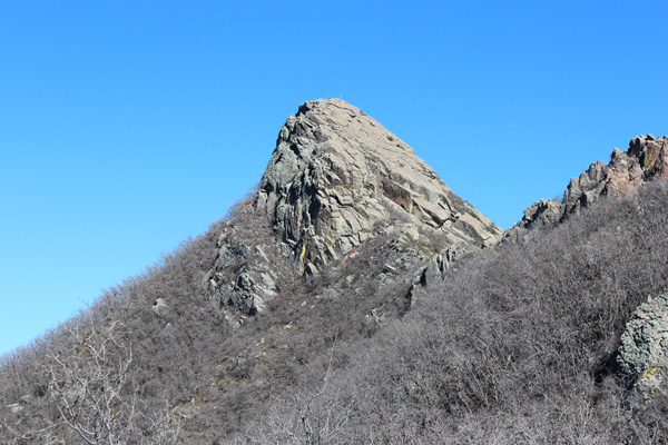
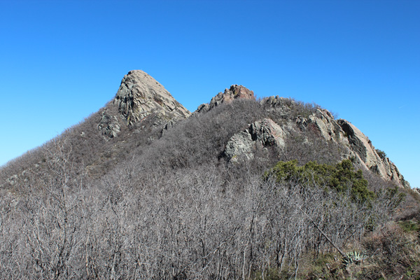
In the view above, we traversed to below the Mount Turnbull summit pinnacle, up the brushy and rocky ramp on the left, then climbed a gully behind the left side that leads to the upper third of the pinnacle. From there we climbed the exposed rock slabs in view to the summit.
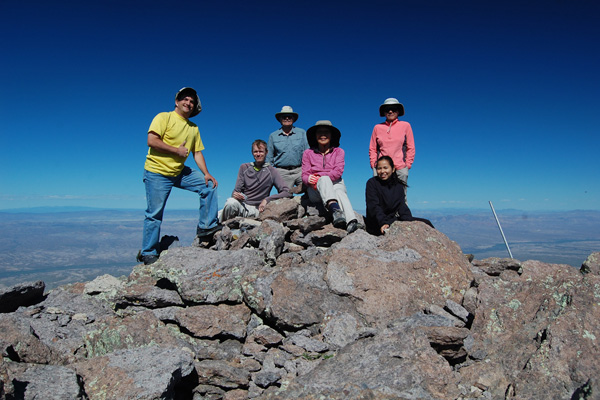
We all seemed to enjoy the last scramble on good footing to the summit. The summit had excellent views in all directions. The team photo above was taken by Eric Kassan using a self-timer.
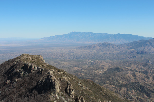
I enjoyed scanning and identifying the mountain ranges and peaks around us. Some of these I had last visited two years ago. Mount Graham, the most prominent peak in Arizona, was quite visible from the summit of Mount Turnbull. I also got my first view of Pinnacle Ridge to our south, the next day’s goal.
We returned to our cars and took the alternative road out. We eventually learned that this was road 660. There was one point where the road forked. We were glad that Richard had recorded a GPS track for the route that confirmed our guess as to the fork to take. In hindsight the other fork would likely have lead out as well. Overall, this road was better than our approach road 556. We finished the long day by driving gravel roads in the dark to find a campsite near Pinnacle Ridge.

excellent account .. enjoyed reading your adventure to summit of mt.turnbull .. a mtn. i always look for & have had great curiosity for a long time. thank you