On Friday, January 24, I joined a large Southern Arizona Hiking Club outing to climb Elephant Head, a rock buttress on the west end of the Santa Rita Mountains. There were 16 of us, 5 men and 11 women, led by Bill Bens and Tammy Derickson. This was the first visit for many of us. The climb of Elephant Head was more than I and others had expected. But everyone reached the top and returned without incident to our cars in good spirits.

We met that cold morning in Tucson and caravanned south, then east, leaving asphalt and finishing the drive on dirt/gravel roads. Bill set a brisk pace from the beginning and I tried to keep up from near the end of the group. At a few rest stops I was able to get some photos but otherwise I just kept moving.
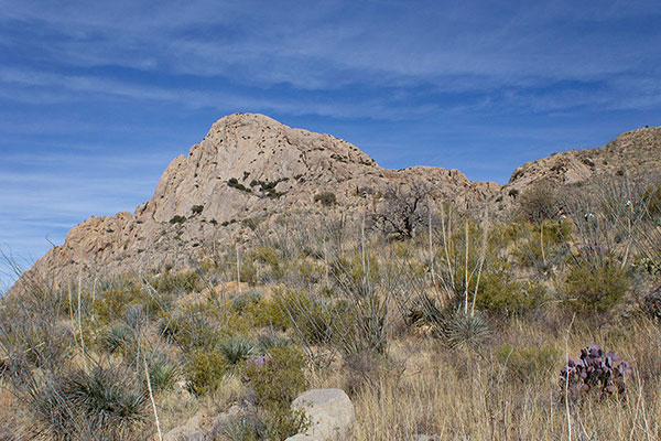
Most of our route was on the Elephant Head and Quantrell Mine Trails. After crossing a pass to the east of Little Elephant Head, we saw Elephant Head, itself, ahead of us. Elephant Head’s South Face, facing us across Chino Canyon, is a rock climbing route with steep slopes and gullies and near vertical cliffs. We needed to gain Elephant Head’s East Ridge which offered a feasible scrambling route to its summit.
To reach the East Ridge we needed to leave the Quantrell Mine Trail and steeply descend 500 feet to the bottom of Chino Canyon, then climb up the other side to the East Ridge. Fortunately, there was a primitive trail to guide us and help with the footing. None of us looked forward to descending and ascending the canyon slopes once more on our return.
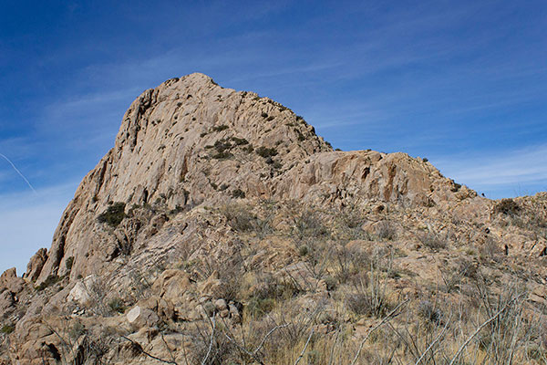

Once on the East Ridge, and after a break, we traveled west along the rocky ridge towards the steep East Face of Elephant Head.
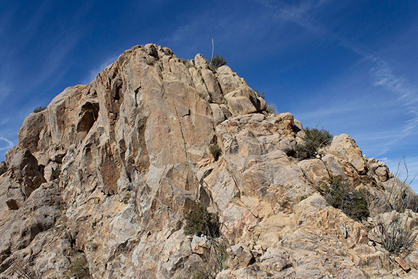
The face rose suddenly and steeply from the ridge. The rock scrambling began.


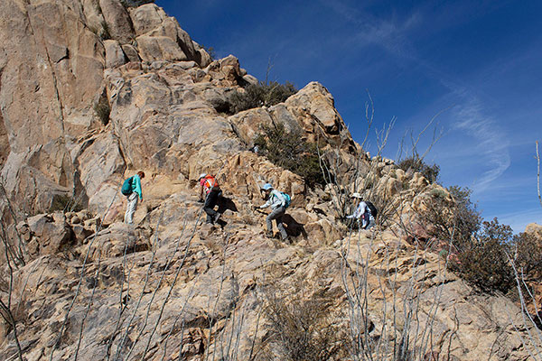
Bill was able to find a route up ledges, chimneys, and slabs of firm rock. I thought the scrambling was fun, and it seemed that everyone else did too. At least everyone was able to continue, with or without some coaching.
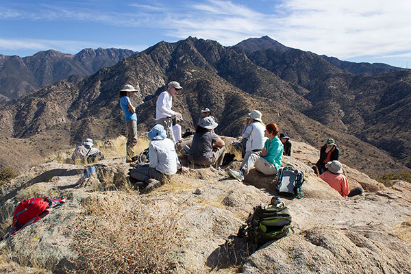
Eventually we all joined together on the summit of Elephant Head. It was later than I had expected it would be.

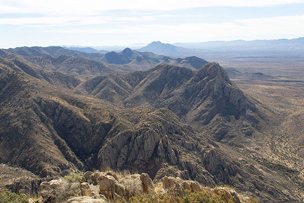
The day was sunny and the temperature had warmed up. We enjoyed our lunch and conversations on the summit. I identified many mountain ranges and peaks to the south, west, and north. Mount Hopkins and other high Santa Rita peaks rose steeply above us to the east.

After a short stay we began our descent off the rock. As expected, this went a little slower for some than had the ascent. But after more fun on the rocks our large group eventually returned to the gentle, rocky East Ridge.

We descended from the ridge into Chino Canyon. To make the best of it each of us set our personal pace climbing out of the canyon. Eventually we each reached the Quantrell Mine Trail above the canyon to regroup. After a last break we followed the trail back to our cars.
I was impressed with the large group; we had a strong team. I enjoyed the scrambling on Elephant Head, and might return some day to experience it, again, including Chino Canyon.

Does anyone know if Bill Bens will have a memorial hike for the Boy Scouts that died on Mt. Wrightson back in 1958.
It would most likely be held around the middle of November 2025.
thank you