GlassMountains Trip Reports

Exploring the backcountry and wilderness of the Western USA.

Trip Reports

  • SITE HOME
  • ALL
  • BICYCLING
  • CLIMBING
  • HIKING
  • SKIING
  • FAMILY

Post navigation

← Previous Post
Next Post →

Broken Top South Peak, Oregon, August 2019

August 11, 2019 by Paul McClellan Leave a Comment

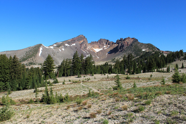
On Sunday, August 4, I hiked and scrambled up Broken Top South Peak in Central Oregon’s Cascade Range. This is the obvious, but not officially named peak 0.34 mile south of the actual summit of Broken Top. It has 454 feet of clean prominence and 9094 feet of elevation. It is most easily accessible from the Broken Top Trailhead which requires a high clearance vehicle to reach.

Broken Top from the southeast. The Broken Top summit lies beyond the Crook Glacier.

The Broken Top Trailhead is very popular since it provides access to the scenic “No Name Lake” below the east face of Broken Top. The parking spaces at the trailhead were full when I arrived, but I found parking beside the road nearby.

Broken Top South Peak. I climbed onto the south ridge up the timbered slope left of the long snowfield, then followed the skyline up to the right.

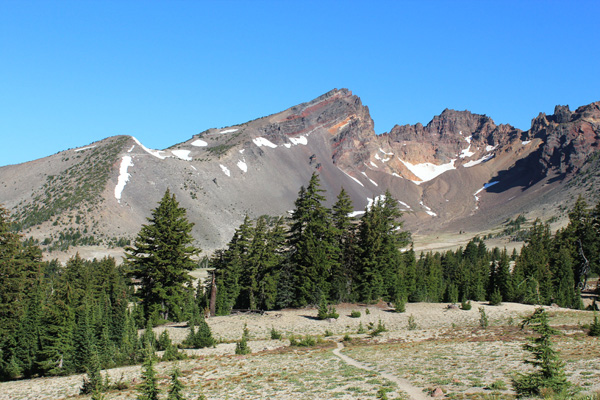
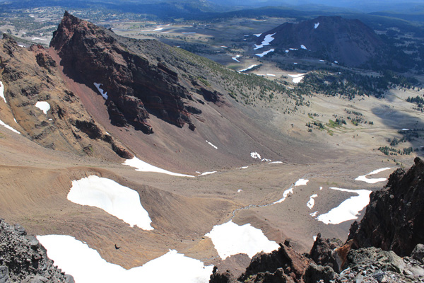
I descended west on the trail, then hiked across open country below the SE facing cirque of Broken Top to reach the south ridge of the South Peak.

Broken Top South Peak from beside the snowfield
Broken Top South Peak from the south ridge. The summit is on the left high above.

I climbed the south ridge beside a snowfield, then climbed directly towards the summit.

The view upwards from higher on the south ridge
The last 200 feet to the South Peak summit

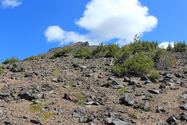
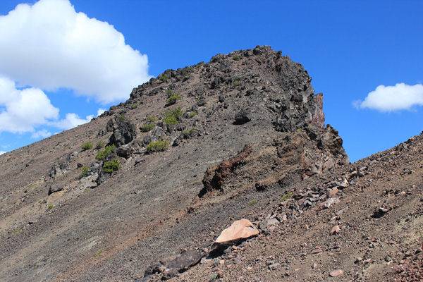
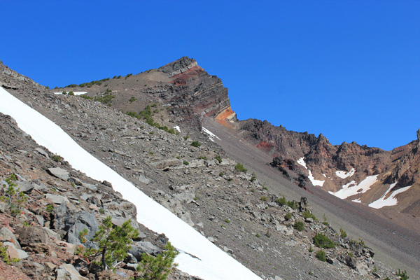
The upper slope was loose scree but a path helped with footing. I scrambled the last 200 feet to the summit up loose and friable rock.

The South Peak summit rocks. The rock on the right is highest.

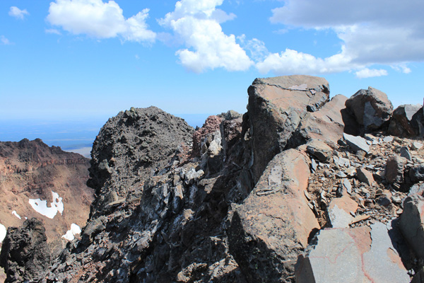
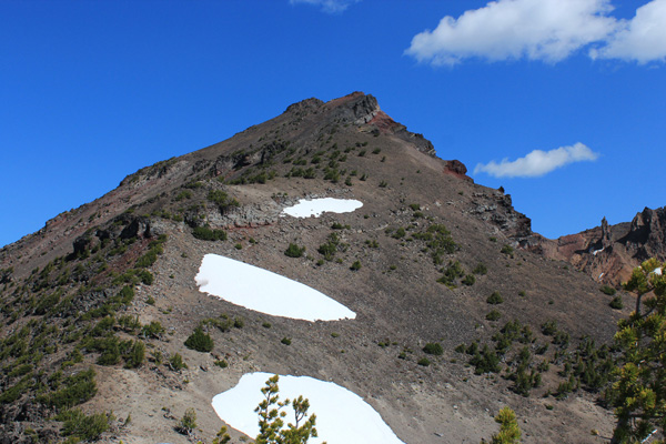
There were two candidate high spots and I thought the nearest one was highest. It provided a nice spot for enjoying the views and photography, though flying insects photobombed some of my photos.

The Three Sisters from Broken Top South Peak. Green Lakes lie below to the left.

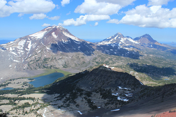
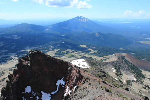
I enjoyed the view of the Three Sisters. The air was clear and the cloud shadows provided contrast and a sense of depth. Green Lakes lay below and I remembered some of the many skiing and climbing trips I have made into that basin with friends.

Broken Top summit from the South Peak
Looking down on the Crook Glacier cirque

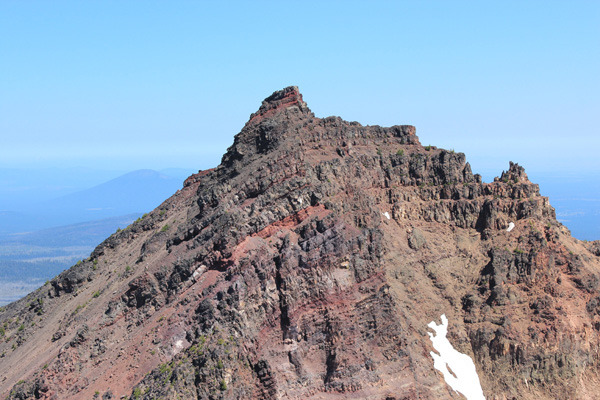
I studied the view of Broken Top from the South Peak. I have climbed Broken Top several times, always up the Northwest Ridge. That route works along red ledges just below the summit. Those ledges seemed very exposed and loose from my viewpoint, but in my experience the rock up there is reasonably firm.

The second candidate high spot is the knobby perch ahead

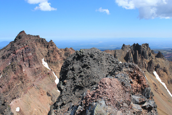
After taking several photos sitting on the first I decided I needed to tag the second candidate to be sure I got the highest. The scramble over to reach this second candidate was easy with good hand holds but loose footing above some exciting exposure. After a few quick photos I gratefully returned to better rock and had lunch.

I descended towards Mount Bachelor following the ridge past the snowfields below.

Clouds were starting to build around me and it was time to return. The descent went more quickly since shifting scree is not as frustrating while going down than up. I took a more direct route down a steep slope to leave the ridge.

Some bright colors on the slopes
The Indian Paintbrush seemed intensely colorful.

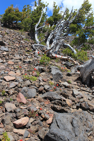
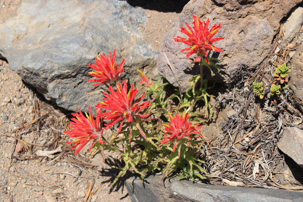
Indian Paintbrush blossoms decorated the lower slopes where snow had lingered into the summer. The seemed particularly vivid.

The sky was darkening to the south as I returned to my Jeep. Rain arrived by the time I had driven out to the Cascade Lakes Highway.

I am glad to have visited Broken Top South Peak and will remember this hike whenever I see the peak on future hikes and bike rides. But I doubt that I will return.

Filed Under: Climbing Tagged With: Broken Top, Oregon, Oregon Cascades

Leave a Reply Cancel reply

Your email address will not be published. Required fields are marked *

RECENT POSTS

  • Southern Perilla Peaks, Arizona, April 2025
  • Peak 2976 (Little Ajo Mountains), Arizona, March 2025
  • Childs Mountain, Arizona, March 2025
  • Slavin Peak and China Peak, Arizona, March 2025

MONTHLY ARCHIVES

Blogroll

  • Arizona Peaks (Peavy)
  • Cycle Uphill (Sharp)
  • Desert Mountaineer (Kasian)
  • Earthline: The American West (Van Winegarden)
  • jessb.org (Beauchemin)
  • New Bohemians (Rogers)
  • Stav is Lost
  • The Mountains of Arizona (Surgent)
  • The Zenith (Baker)

Site content Copyright © 2025 Paul J. McClellan. All rights reserved.
Copyright Details
Log in