On Christmas Eve I hiked to the summit of Sala Benchmark, a peak in the Southern Dragoon Mountains of Arizona. Sala Benchmark has 1264 feet of topographic prominence and rises to the east above Cochise Stronghold.
![Cochise Stronghold, China Peak, and Sala Benchmark from Middlemarch Road](https://www.glassmountains.us/wp/wp-content/uploads/2024/12/salabm01_600.jpg)
Several of people had visited it before me and had published helpful trip reports. This was to be a short hike, mostly on an unmaintained trail. I expected few surprises.
![Sala Benchmark is the high point on the left in this view from Middlemarch Road](https://www.glassmountains.us/wp/wp-content/uploads/2024/12/salabm10_600.jpg)
![Cochise Stronghold from Middlemarch Road. Sheepshead is just right of center.](https://www.glassmountains.us/wp/wp-content/uploads/2024/12/salabm08_600.jpg)
![Sala Benchmark left of center. My route will follow the high ridge right to left.](https://www.glassmountains.us/wp/wp-content/uploads/2024/12/salabm11_600.jpg)
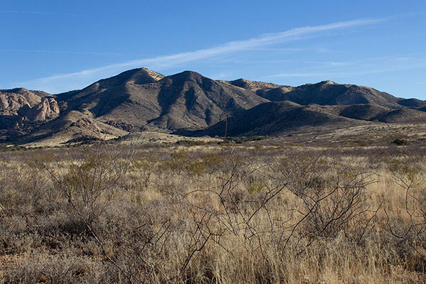
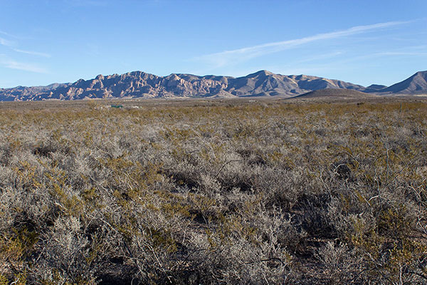
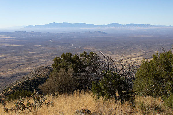
I took a relaxed approach to the hike, stopping on the drive in for several photographs of the southern Dragoons. The roads were in good shape and I found a good parking spot at Middlemarch Pass.
![From Middlemarch Pass I climbed a steep slope to my left to gain the Southeast ridge above](https://www.glassmountains.us/wp/wp-content/uploads/2024/12/salabm12_600.jpg)
![Climbing low on the Southeast Ridge, I found the unmaintained trail to my left](https://www.glassmountains.us/wp/wp-content/uploads/2024/12/salabm13_600.jpg)
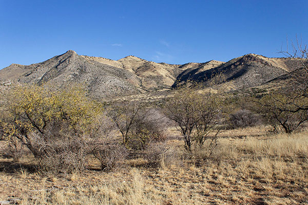
I started west up a steep open slope to reach the southeast ridge above me. After climbing northwest on this ridge through grass and over loose rocks I soon found the unmaintained trail. It was much easier following this trail higher.
![My first view of Sala Benchmark from the Southeast Ridge](https://www.glassmountains.us/wp/wp-content/uploads/2024/12/salabm14_600.jpg)
![Mountain Yucca (Yucca madrensis) beside the trail](https://www.glassmountains.us/wp/wp-content/uploads/2024/12/salabm15_600.jpg)
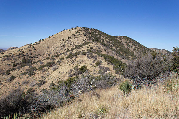
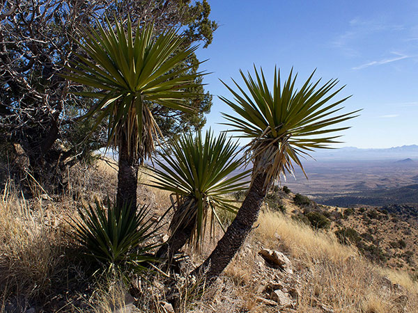
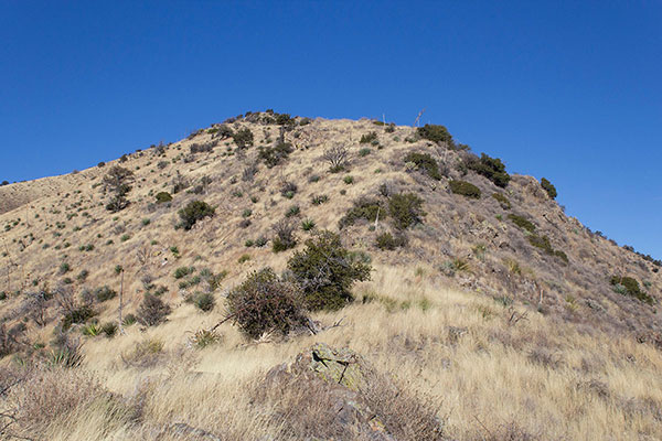
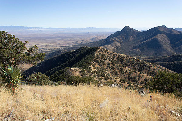
At a subsidiary point I finally saw the Sala Benchmark highpoint ahead. Here I also found an attractive yucca plant and paused for several minutes to photograph it from several angles, hoping to identify it later.
![The Sala Benchmark summit, the ridge highpoint near SALA BENCHMARK](https://www.glassmountains.us/wp/wp-content/uploads/2024/12/salabm22_600.jpg)
From there I continued higher on the trail through a short forested area and then on to the summit.
![Black Diamond Peak on the left and Peak 7155 just in view in the center to the south](https://www.glassmountains.us/wp/wp-content/uploads/2024/12/salabm26_600.jpg)
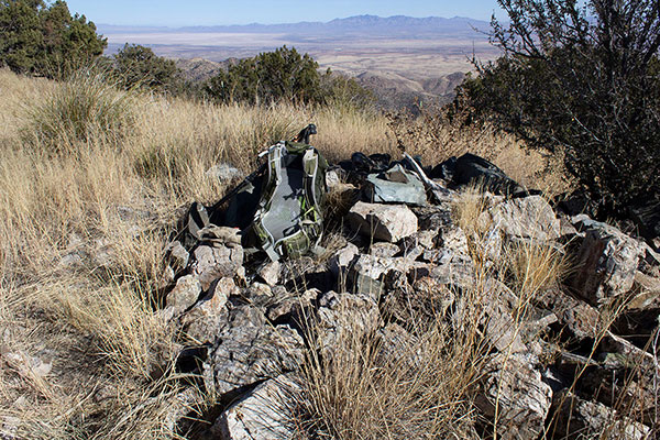
The summit was marked by a pile of rocks a few feet from the SALA BENCHMARK. I found two summit registries in glass jars. The paper in the older jar was brittle and fused together. I did not attempt to pull the pages apart. The newer registry was in very good shape and I enjoyed reading the entries in it before adding my own.
![The City of Tombstone and the Huachuca Mountains lie to the Southwest](https://www.glassmountains.us/wp/wp-content/uploads/2024/12/salabm28_600.jpg)
![The Chiricahua Mountains and the Sulphur Springs Valley lie to the east](https://www.glassmountains.us/wp/wp-content/uploads/2024/12/salabm29_600.jpg)
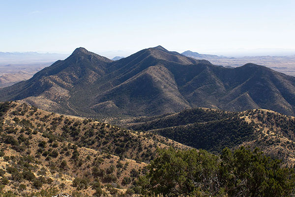
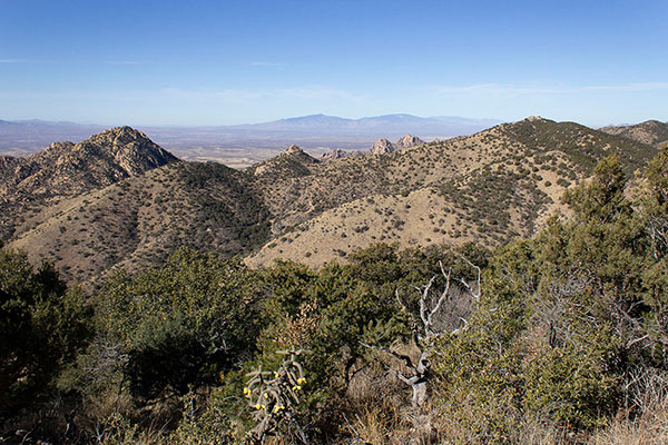
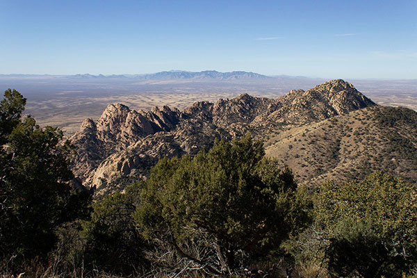
I had an early lunch, then took photos of the many familiar mountain ranges around me. I identified several peaks in the Dragoons I had not yet visited. The weather was ideal.
![The Northern Dragoon Mountains from Sala Benchmark](https://www.glassmountains.us/wp/wp-content/uploads/2024/12/salabm38_600.jpg)
![The Rincon Mountains and China Peak on the right to the northwest](https://www.glassmountains.us/wp/wp-content/uploads/2024/12/salabm41_600.jpg)
![The Mustang and Whetstone Mountains to the WSW](https://www.glassmountains.us/wp/wp-content/uploads/2024/12/salabm42_600.jpg)
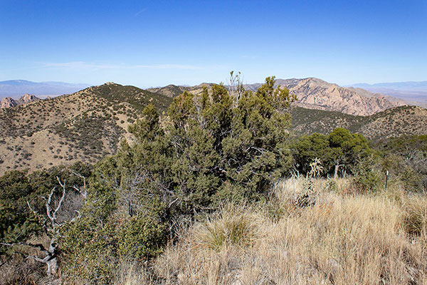
I followed the summit ridge through forest to the north to be sure I had tagged all candidate high points. The views to the north were better from there.
![My view down the Southeast Ridge](https://www.glassmountains.us/wp/wp-content/uploads/2024/12/salabm43_600.jpg)
I returned to the summit, then packed up and descended the trail back down the ridge. Once above Middlemarch Pass I left the trail on the ridge and descended the steep slope to my Jeep.
On the drive out I paused to identify the starting point for a nearby peak I plan to visit this winter. I also detoured through Sonoita on my way home to find the trailhead of another peak to visit in the Whetstone Mountains. It had been a relaxed, solitary, and rewarding day of hiking in the Dragoons.
Leave a Reply