GlassMountains Trip Reports

Exploring the backcountry and wilderness of the Western USA.

Trip Reports

  • SITE HOME
  • ALL
  • BICYCLING
  • CLIMBING
  • HIKING
  • SKIING
  • FAMILY

Post navigation

← Previous Post
Next Post →

Hurwal Divide, Oregon, August 2020

September 9, 2020 by Paul McClellan Leave a Comment

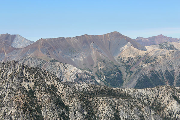
On Wednesday, August 26, I climbed Hurwal Divide. Hurwal Divide lies in the Eagle Cap Wilderness, part of the Wallowa Mountains, and gets its name as the steep divide between Hurricane Creek to the west and the West Fork Wallowa River to the east. It has 9776 feet of elevation and is the seventh highest peak in Oregon (with at least 500 feet of prominence).

The Hurwal Divide from Aneroid Mountain (2013-08-07)

Tuesday afternoon I drove to the north side of the Wallowa Mountains and car camped near the Hurricane Creek Trailhead. The trailhead was busy and I was fortunate to find such a nice spot to camp nearby beside Hurricane Creek.

The Northwest Ridge of Sacajawea Peak, the highest peak in the Wallowa Mountains, from the Hurricane Creek Trail

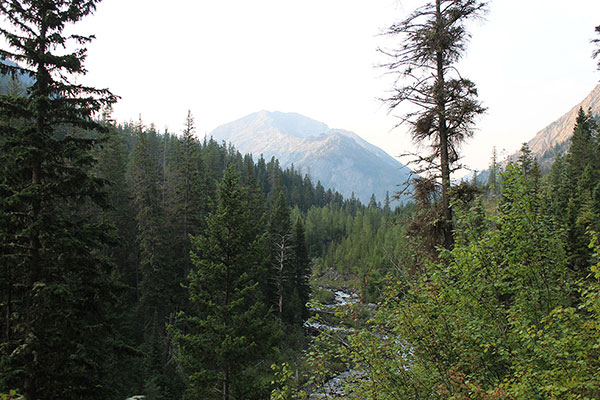
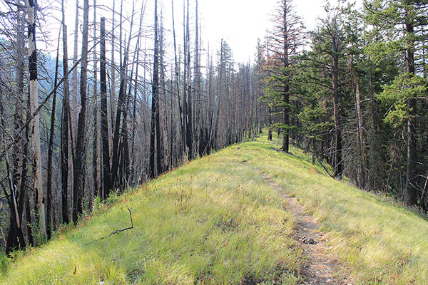
Early Wednesday morning I left the Hurricane Creek Trailhead and followed the trail south along Hurricane Creek. The trail was gentle and I enjoyed the morning views and paused several times for photos. Several other hikers passed by.

The improvised log bridge over Hurricane Creek

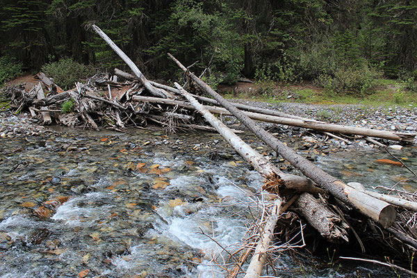
Seven years earlier I had explored access to the Hurwal Divide this way and at that time had missed the poorly marked trail junction leading towards Thorp Basin. After backtracking I followed a minor trail and found the log crossing over Hurricane Creek. This time I was watching for the junction, but I did not recognize it after the years and passed it again. Eventually I returned and followed the minor trail to Hurricane Creek. The double log crossing was still in place and I carefully sidestepped across the logs over the wide creek.

A view of Sacajawea Peak's Northwest Ridge from the Thorp Creek Trail
A view of Sacajawea Peak’s Northwest Ridge from the Thorp Creek Trail
The Thorp Creek Trail becomes less steep as it climbs the narrow ridge separating Twin and Thorp Creeks

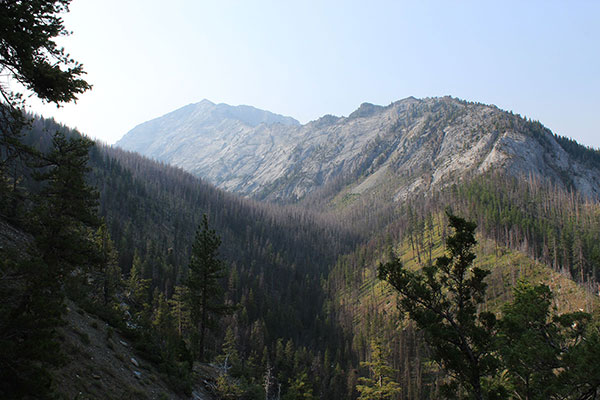
From the east side of Hurricane Creek I climbed the sometimes steep Thorp Creek Trail towards Thorp Basin. I met a couple descending from Thorp Basin, but otherwise saw no one else on this side of Hurricane Creek.

At about 7800 feet the slope opens up to show the upper northwest ridge leading to the false summit above

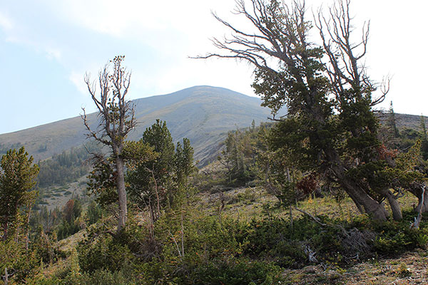
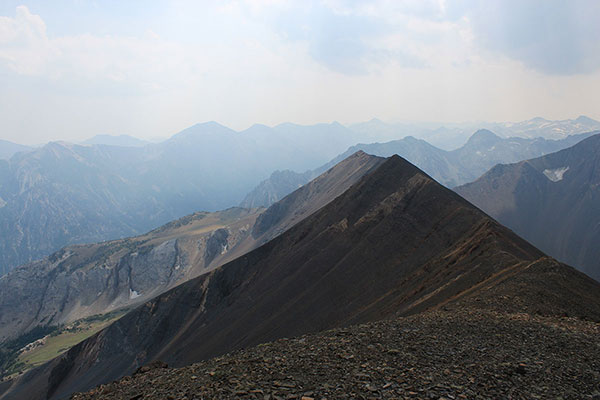
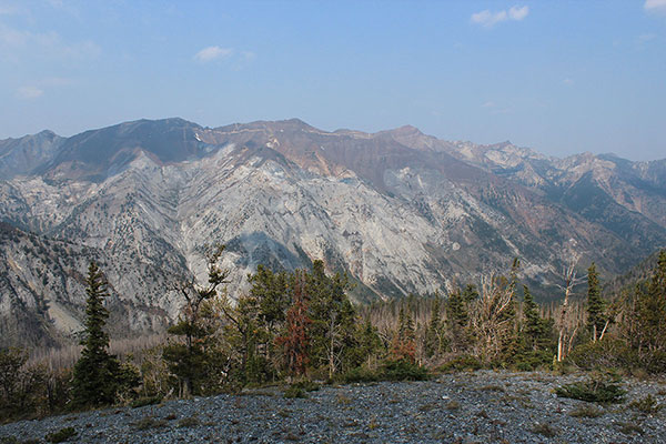
At about 7200 feet I left the Thorp Trail and climbed to the ridgeline above me to my left. Reaching the ridgeline I followed it through a recent burn. The burn debris was not difficult to pass through. Higher the slope opened up and I got a good view of the upper northwest ridge.

Approaching the false summit of Hurwal Divide from the northwest ridge
My first view of the Hurwal Divide summit

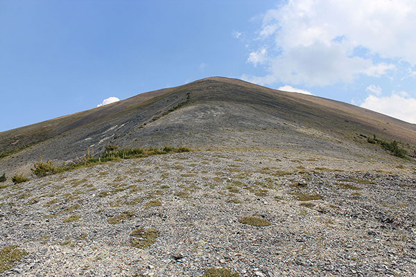
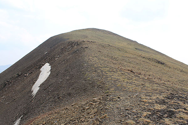
I climbed steeply up sometimes loose scree towards a false summit. As I climbed I watched cumulus clouds build above me and hoped any poor weather would hold off while I was on such exposed slopes. From the false summit I finally saw the summit of the Hurwal Divide.

A mountain goat (Oreamnos americanus) pauses on talus slopes and looks back at me as I climb above to the right on the ridgeline
The last 150 vertical feet to the summit

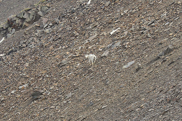
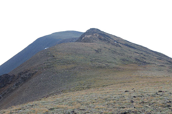
The remaining hike to the summit was lower angle on firmer footing. I passed a mountain goat watching me from below the summit ridge.

The Hurwal Divide summit with Chief Joseph Mountain to the north
Looking south along the Hurwal Divide summit with Pete's Point left of center and Cusick Mountain beyond Hurwal Divide just right of center. It was a smoky day.
Looking south along the Hurwal Divide summit with Pete’s Point left of center and Cusick Mountain beyond Hurwal Divide just right of center. It was a smoky day.
Looking SW from the Hurwal Divide summit with Eagle Cap, Matterhorn, and Sacajawea Peak from left to right

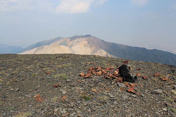
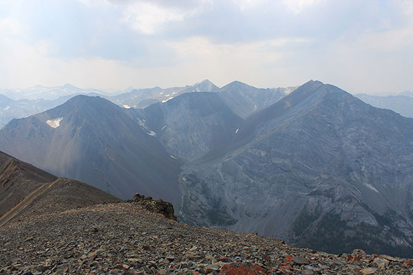
I eventually reached the broad summit of the Hurwal Divide. The sky was smoky and cumulus clouds continued brewing up. It would have been easy to spend several hours enjoying the view and the the ambiance of the summit, but I could not linger long.

Looking down into the Hurricane Creek Valley from the northwest ridge of the Hurwal Divide
Fireweed (Chamaenerion angustifolium) blossoms beside the Thorp Creek Trail where there had been a wildfire

After lunch and photos I descended back down to Hurricane Creek and out to the trailhead. I heard thunder shortly before returning to my campsite and Jeep. It had been a longer day than I had expected, but it was very satisfying to finally visit the summit of Hurwal Divide, which I first spotted 31 years ago from Sacajawea Peak.

Filed Under: Hiking Tagged With: Hurwal Divide, Oregon, Wallowa Mountains

Leave a Reply Cancel reply

Your email address will not be published. Required fields are marked *

RECENT POSTS

  • Southern Perilla Peaks, Arizona, April 2025
  • Peak 2976 (Little Ajo Mountains), Arizona, March 2025
  • Childs Mountain, Arizona, March 2025
  • Slavin Peak and China Peak, Arizona, March 2025

MONTHLY ARCHIVES

Blogroll

  • Arizona Peaks (Peavy)
  • Cycle Uphill (Sharp)
  • Desert Mountaineer (Kasian)
  • Earthline: The American West (Van Winegarden)
  • jessb.org (Beauchemin)
  • New Bohemians (Rogers)
  • Stav is Lost
  • The Mountains of Arizona (Surgent)
  • The Zenith (Baker)

Site content Copyright © 2025 Paul J. McClellan. All rights reserved.
Copyright Details
Log in